Let’s talk about permeability. No, this is not about hairstyles. It’s about the ability to travel through a medium, place or object. Say, a city.
Places tend towards permeability if given the chance. Yes, there are rivers, steep hills, and forests to contend with, but by and large, people find a way through. This is a human phenomenon. An animal phenomenon.
The generations before us knew about permeability. Just a few generations ago, riding around on a bicycle was a primary means of transport, and this relied on the permeability of the town or district. In KL that has mostly been swept up and away in the mass of tangled highways. You don’t have to look far to find people who growing up didn’t think of using a bicycle as ‘cycling’ - it was just jalan jalan, and it was free and easy.
The modern city in Malaysia is becoming a ‘severed’ place rather than a permeable one. Forces are at work making this happen, going against the grain. It is usually the construction of a wall or a fence. Why do we need these barriers? Why do we need to sever one place from another? The two main causes of the barriers in the Klang Valley are highways and fenced property.

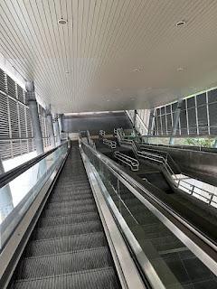
Highways are touted as providing connectivity, but do the sponsors and planners stop to consider that highways also bring severance? They sever districts through the insertion of fences and other barriers coupled with heavy traffic thundering along in a near-continuous stream. Not something easy to cross, to say the least. This can have far-reaching consequences for an area, resulting in severed communities. What once was a short walk now may be a long drive, with little or no alternative but to get on the highway. Cycle around the Klang Valley and you will usually find your preferred route blocked by highways. Some footbridges are provided - but not nearly enough. They clearly haven’t been planned with active travel in mind. Of course, with highways typically being toll roads, it is in the developers’ and operators’ interests to encourage car use and discourage active travel.
Cycling is an incredibly flexible mode of transport - you can ride 5 minutes to the shop, go touring (maybe with the help of a train), invade a country, or take it off road, over the hills and far away. There are so many options. So a bicycle can be used in a shared space with pedestrians, on a motorcycle lane, on a road, on a gravel track, or, yes, even on a dedicated bicycle path. Perhaps this is a curse, as well as a blessing. Without a well defined need for bicycle-specific infrastructure, cycling routes get overlooked.
What this all means is that we’ve ended up with areas in Greater KL that you can’t escape except by using a highway. Easy, accessible routes can be worked into highway proposals for little extra cost, if the will is there.

Modern private property developments in the Klang Valley tend to be relatively large scale. A common first step for a developer is to put a big fence around the new development site, thus reducing permeability. Attitudes towards private property, land access rights, so called ‘security’, and various other aspects of the collective psyche can probably explain this to some extent. There are simpler explanations too. Perhaps the planner or developer doesn’t walk or cycle. That would be perfectly normal nowadays in the Klang Valley. If they never use active travel themselves, why would they think to cater for others who might? Everybody knows that cars are the only way... Education in planning and urban design can tackle this, together with planning policy: mitigate severance caused by developments, maintain and enhance urban permeability.
On the other side of the coin, the Klang Valley has many mature housing areas that are inherently permeable, with little lanes, alleys, parks and bridges. Nowadays, many of these areas are fenced, like a compound. People approvingly talk about their area being ‘gated and guarded’ - hideous terms better suited to a barbed wire dystopia. Nothing says selamat datang like a 10-foot fence topped with razor wire.

Welcome to the neighbourhood.
But where does this trend for fences come from? There has been a history of fenced housing areas in Malaya for decades, particularly acute during the emergency years. The British set up New Villages with perimeter fences to combat communist activity. Did the residents decide they liked the fences? Or did they just get used to it and as time went by, forgot that it could be different? It is sad that people use the warped excuse of ‘security’ or ‘safety’ today (but that is a discussion for another time).

Let’s look at a few quick examples of severance caused by fences.
There is a road from TTDI, through Kampung Penchala and up to Desa Park City. Well, there was once. It was a pleasant and convenient route on the bicycle, using a small lane along a babbling river. Even better, the end of the road was a modal filter, blocking motorised traffic. This made the road quiet and calm. In 2021 the route was blocked by an uncompromising fence and barbed wire. Some try to bypass the fence by going through the forest - a route unsuitable for most. It looks like a typical case of the ‘one way in, one way out’ mentality. With a little imagination and minimal budget, the route could be opened up to active travel, with all the benefits that would bring.
The developer is ParkCity Holdings, a subsidiary of Samling. From Samling’s own website: “Samling Group and all its subsidiaries strongly believe in environmental protection and sustainable social-economic practices which caters to long-term business growth”.
Just going to leave that there.
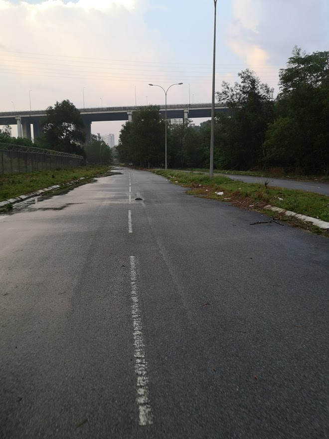
The road to Desa Park, now blocked.
There will surely be arguments for and against barriers in each situation, and in some rare cases a fence might be the least worst option. But the point isn’t about one example, the point is that this is a trend and it’s happening everywhere. Maybe permeability for active travel around the city just isn’t on anyone’s radar. The people whom it currently affects the most are probably foreign workers, with little if any voice in these kinds of matters. Maybe there is nobody representing these interests

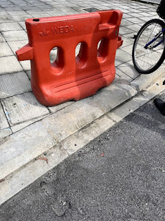
A modest barrier in a typical PJ housing area. This one is traversable, but not convenient. There are plenty of other examples of high fences or mega gates. No welcoming vibes allowed.

It is not only private property that can cause massive severance - parks, campuses, and other areas in the city are also often fenced, cutting routes for active travel.
Let’s not forget that there are a few success stories, though. Thumbs up to the golf course near the KL/PJ border that lets you cycle through it (but is it supposed to be a public road anyway..?).
There are good arguments for preventing motorised traffic in certain areas, but do these same arguments hold up against active travel? That’s where the modal filter steps in. Some housing areas deploy these filters to great effect, blocking cars, and sometimes motorbikes, but remaining open to walking, jogging, or cycling. There are plenty of examples of this kind of filter around KL, so it’s not something new. What might be new is integrating it into a transport strategy.
While this discussion has singled out highways and fences as the causes of severance, there are other culprits lurking about in the shadows. Technology has brought differences in the way the city is planned and constructed. For example, modern retaining walls can be made much higher more easily than they could a century ago. Where little terraces would have once been the norm, six metre tall concrete retaining walls now tower around us. Few of us would consider scaling a wall like that as part of our daily commute, let alone doing it carrying a bicycle. Let’s remember: it is our choice how we implement technology.

A final thought - about intuition, and the severing of it. Intuitively, how to get from A to B? If you start at A, head in the direction of B mah? No. Wrong! Not in the Klang Valley. More likely, head in the opposite direction. This could be different. For a city with a high degree of permeability, if you head towards B, by and large, you will end up at B. Navigating without a sense of direction is a bizarre concept to me, but something increasingly normal to KLites. Maybe technology is solving the problem - just got to turn brain off, turn Waze on. But the tortuous routes we now take add on the miles, add on the minutes, add on the pollution, and add on the stress.

___
OK, so the city has a problem with permeability, and it’s been heading in the wrong direction for a while. But there are little positives here and there - modal filters, bicycle maps, footbridges, and private roads open to active travel. Things that are valued by people. Let’s build on these things, raise awareness and change minds. There is a growing group of bicycle users who can spread the word and mobilise. Who knows, with a few turns of the pedal, we might just get somewhere.